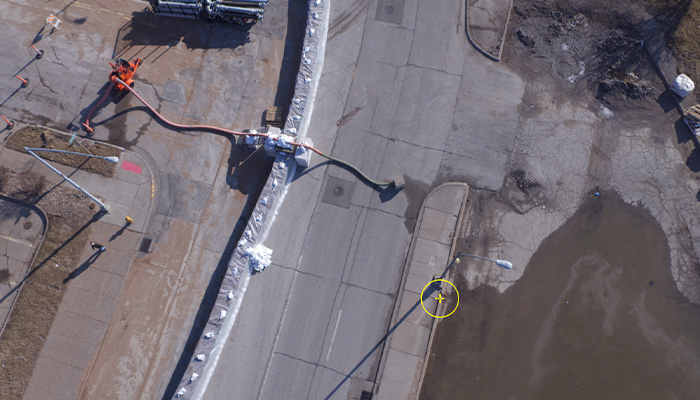
Documenting Storm Damage
Through the use of drone technology, our certified drone pilot(s) produce vibrant, dynamic HD aerial video and photos that are immense valuable when documenting storm damage.
Through the use of drone technology, our certified drone pilot(s) produce vibrant, dynamic HD aerial video and photos that are immense valuable when documenting storm damage.
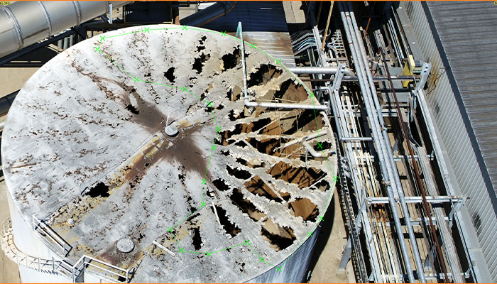
Our process of drone mapping and modeling offers complete coverage of your site. We are not only experienced in mapping and 3D modeling from a top down, birds eye view – but also oblique mapping of the facades of buildings and sides of vertical structures. This enables you to access ultra-high-resolution imagery to inspect areas in 3D. The high resolution and full, three dimensional coverage greatly reduces the potential to miss critical information in the field.
This data is catalogued and stored providing the ability to reference it in the future. The catalogue of data serves as a 3D visual time capsule of conditions on the site on that particular date. If conditions have changed, or the damage is cleaned up before realizing that something has been missed, you can rest assured that you have the data stored safely. This can also be compared to future flight data for useful analysis of changes in site conditions.
Not only do we provide an ultra-high-resolution visualization of your entire site, but every pixel in our imagery has accurately georeferenced coordinates and elevations associated with it (we often fly sites with sub-centimeter pixel resolution, providing an immense amount of data). The high resolution imagery can be used to identify damaged areas and then provide the ability to pull the coordinates and elevations of these points to help coordinate relief efforts. Through utilizing precise mea-surements from this data, we can calculate the location, surface area or volume of any areas of concern. This information can also be brought into AutoCAD and other softwares for further analysis. Future surveys can then be imported at the exact same location for direct comparison of site improvements over time.
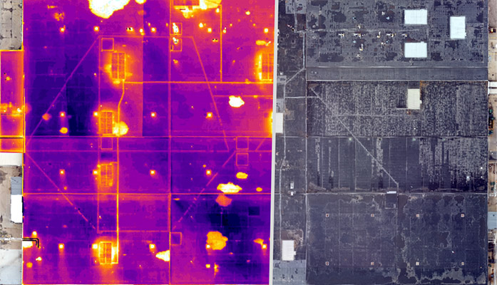
Our drone mounted thermal camera can be used to help identify moisture penetration, wet insulation and other issues related to the exterior of your buildings. We are able to overlay our thermal maps on our true color (RGB) maps and 3D models for direct analysis.
We can mobilize rapidly. Once we are on site, data is collected efficiently. This allows you to begin making informed decisions more quickly than waiting for other methods of documentation.
It can be very dangerous to assess structural damage. Our drone services provide safe and non-intrusive means to collect data without risking life and limb by climbing on dated or damaged structures.
